Our history

Noosa Parks Association (NPA) is Queensland’s oldest community-based conservation organisation. NPA has had a massive influence in shaping how the Noosa Shire developed over more than six decades. What follows is a brief summary of NPA’s stellar achievements.

Laguna Bay. Photo: Tony Wellington

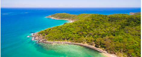
Noosa National Park

The battle to protect the Noosa headland from development began as soon as Noosa Parks Association (NPA) was formed in 1962. At the time, the headland’s national park was just 240 hectares, and nowhere did the protected area meet the sea. The Noosa Council of the day planned to build a roadway along the foreshore, from Hastings Street all the way around the headland to Sunshine Beach. This would have facilitated development of the entire foreshore as well as open up privately-owned land at Alexandria Bay.

NPA committee 1962
NPA committee 1962

Led by Dr Arthur Harrold, NPA succeeded in getting the state government to expand the existing national park so that it included the coastal strip, thus thwarting council and developers from urbanizing the headland.

Having rescued the foreshore, the next step was to get the land behind Alexandria Bay included in the national park. At the time, this crown land was earmarked for development by the state. There was also a sand mining lease application for the area. After a public education campaign and much NPA lobbying, in 1967, the state government finally relented and their landholdings at Alexandria Bay were added to the Noosa National Park.

Alexandria Bay from Hells Gates

A significant piece of the jigsaw was freehold land south of Alexandria Bay, earmarked for development by TM Burke Pty Ltd. This included Paradise Cove and The Devil’s Kitchen. NPA lobbied to have a parcel of state-owned land, known as the Water Reserve, included in the national park, thus preventing any road access to the land held by the developer. It would take another 12 years for that land to be included in the national park as part of a land swap deal with the developer. The final pieces of the headland section of the Noosa National Park were added in 1989.

View from Emu Mountain looking north

At the same time as fighting to secure the headland, NPA set its sights on preventing the sort of seaside urban development that dogged so much ocean frontage, not only elsewhere on the Sunshine Coast but also the Gold Coast. Peat and mineral mining in the coastal wallum had to be fought off, as did rapacious developers. Under the original plans, the coastal strip between Noosa and Coolum would have housed an extra 30,000 people. Instead, piece-by-piece, most of the coastal land between Noosa headland and Coolum Beach was added to the Noosa National Park, forming a long greenbelt. A new motorway was prevented from being constructed around Lake Weyba, and a massive development for Peregian that included a Spaceworld theme park was also stymied.

In 2001, after four decades of NPA persistence, the Marcus Beach high dunes were finally added to the national park. At the same time, 15 other parcels of land, including parts of Emu Mountain, were gazetted for permanent protection. More recently, land either side of the Sunshine Coast Motorway has been incorporated into the Noosa National Park.

The result of these decades of effort is a sizeable national park that protects the Noosa headland and the coastal strip south of it. The headland has become not only iconic, but also the most visited national park in Queensland. What’s more, driving south from Noosa is through remnant wallum heath rather than more urban sprawl.

Information Hut at Noosa National Park
Information Hut

In 2008, NPA won a state tender to operate the information hut at the Park Rd entrance to the national park. Profits from sales at the hut have been used to secure environmentally sensitive land elsewhere in the shire.

Cooloola

Teewah Beach
Teewah Beach

From the get-go in 1962, Noosa Parks Association (NPA) had its sights set on rescuing Cooloola from sandmining, logging and development. Along with K’gari (formerly Fraser Island), Cooloola represents the largest vegetated sand mass on the planet, a true geological marvel. At its heart is the Noosa River, making its way over 74 kilometers to reach the sea at Noosa Heads. The diverse natural bounty includes wetlands, coastal heath and a range of forest types, including the only rainforest known to grow on high coastal dunes. The Great Sandy National Park also plays host to half of the world’s perched lakes.

Poona Lake
Poona Lake

In the 1960s, there were mining lease applications covering most of Cooloola. Indeed, some mining businesses were extracting material without even bothering to get approvals in place. Meanwhile, the old growth forests were being plundered for their timber.

Remains of timber loading jetty at Poverty Point

NPA led the charge against this rapacious exploitation and was soon joined by other groups including a sister organisation, The Cooloola Committee, plus The Wildlife Preservation Society of Queensland. A series of campaigns, including 15,000 postcards sent to Premier Joh Bjelke-Petersen and a petition containing 24,000 names, resulted in a pitched battle in the joint party room of the state government. People power eventually forced the premier into a humiliating backdown, and mining was finally banned in Cooloola.

In 1971, the Fraser Island Defenders Organisation succeeded in having a 25,000 hectare national park declared for K’gari. Finally, in 1975, the first stage of a Cooloola National Park was gazetted, covering 24,000 hectares. But timber interests continued to extract 2,700 cubic metres of commercial timber annually from Cooloola’s tall forests.

Cooloola western catchment

Eventually, thanks to NPA’s lobbying efforts, Cooloola’s western catchment was added to the park as well as other parcels. The arrival of the Goss Labor Government in the early 1990s saw the phasing out of logging and significant expansion of the protected areas. A 1994 management plan joined Cooloola with K’gari into one huge national park of 240,000 hectares.

Cooloola from Mt Tinbeerwah

Cooloola still faces challenges, and NPA is involved in efforts to find solutions to these problems. Not least of them is the continued use of Teewah Beach as a through-road, and the environmental impact of thousands of people camping on Teewah Beach. There are also issues around water extraction from the Noosa River upper catchment, plus state government proposals for more commercial activities in the park. Licenses have been awarded to tourism operators to take boat tours up the river as far as the Cooloola Sand Patch. Riverbank erosion caused by boat wash is a matter of concern to NPA.

The Cooloola Sand Patch looking westwards

In 2001, NPA won an open tender process to repair, manage, and operate the lighthouse cottages on Double Island Point. Using volunteer labour, the cottages were renovated, and over two decades NPA volunteers have removed much of the invasive weed species that previously contaminated the headland.

Lighthouse cottage at Double Island Point

The Built Environment

View from Noosa lookout

Noosa Parks Association’s many environmental victories were won by working with (and often counter to) governments at all levels. It was thus inevitable that NPA members would choose to participate more directly in political decision-making by standing for election to the local council.

The interrelationship between the natural environment and the human-made environment has long been at the heart of NPA’s endeavours. From the outset, NPA envisaged Noosa as a place where the human footprint trod lightly on the landscape, where the natural scenery took precedence within that landscape, and where big city symbols such as traffic lights, billboards and high-rise buildings were avoided. This has historically been referred to as a “village feel”, and it remains one of Noosa’s key elements underpinning the locale’s attractiveness and resident amenity.

Since 1979, various members of NPA have been elected to the Noosa Council, and two have become mayor. Most notable is the three-term mayoralty of Noel Playford between 1988 and 1997, during which time the town plan was revised to restrict building heights and to limit urban sprawl. Noel liaised closely with NPA’s Michael Gloster in establishing a new approach to urban development. An idealised population cap for the shire became part of the template for future town plans. What’s more, a whole swag of inappropriate developments was fought off, including a proposal for a massive development on the Noosa North Shore that included a jet airport.

Because of this approach to low-key development, Noosa soon became a magnet for high-end tourism.

Amalgamation protestors

In 2007, the Beattie State Government decided to amalgamate councils cross the state, including the merger of Noosa with neighbouring Maroochy and Caloundra Shires. NPA joined others in condemnation of the plan, knowing that it would ultimately undermine Noosa’s distinct values. Despite protests, amalgamation went ahead in 2008, subsuming Noosa into the fourth largest local government in Australia.

A local campaign to regain the Noosa Shire through de-amalgamation played out for the ensuing 6 years, finally winning over a new LNP government, thanks to NPA’s efforts alongside other local community groups, most notably Friends of Noosa.

Free Noosa launch
Free Noosa launch

In 2013, a local poll on the question of Noosa’s de-amalgamation saw 81% of residents voting in favour. January 2014 thus saw the reestablishment of a new Noosa Council, with NPA members Noel Playford and Tony Wellington being elected as mayors on the ensuing two councils.

The challenges for Noosa going forward are: to halt the exponential growth of tourism that threatens resident amenity; retain the key elements that make Noosa an attractive place to live; hold off pressure to increase the size and density of the local population; and manage Noosa’s natural areas for future generations.

A Ring Of National Parks

koala
Koala

NPA proposed converting Tewantin State Forest into national park in the early 1970s.

In 1998, NPA commissioned Noosa & District Landcare to carry out a flora and fauna study of the Tewantin State Forest plus the important vegetation linkage through Ringtail Forest. The studies revealed some very special ecosystems and a range of threatened and at-risk species.

Tewantin National Park

Following significant lobbying efforts, at the end of 2005, the state government announced that Tewantin State Forest would be progressed from forest reserve status to national park sometime in the future. It took another 5 years for the state to gazette the national park. NPA redoubled its efforts to get Yurol and Ringtail State Forests similarly gazetted.

Parts of the Yurol and Ringtail Forests were planted out with native hardwood, while other areas were also under pine plantation licensed to HQ Plantations. There were also very significant stretches of untouched native forest. In a truly audacious plan, NPA’s Michael Gloster idealised a three-way partnership deal, in which the state government, the Noosa Council and NPA would together buy out the plantation harvesting rights and convert the land back to native habitat suitable for national park designation.

Michael and others first approached HQ Plantations, who were willing to consider the wild scheme. The Tony Wellington-led Noosa Council came on board and together, council and NPA convinced the Queensland Government to participate. NPA, Noosa Council and the Queensland Government shared the $3.5 million purchase of the plantation rights. The result is that the pine forests and hardwoods have been harvested, and these areas are now being revegetated into native forest.

Signing of the Yurol Ringtail Agreement

Local First Nation people, the Kabi Kabi, were also brought into the Yurol-Ringtail project and have given it their imprimatur. The whole venture has become a landmark example of how private interests, two levels of government, and a volunteer conservation organisation can all work cooperatively for the betterment of the natural environment.

The total area of Tewantin, Yurol and Ringtail Forests is nearly 10,000 hectares, a massive addition to Noosa’s protected estates.

Greater Glider
Greater Glider

Recent research has revealed that the Yurol and Ringtail Forests are home to surprising numbers of threatened and endangered species including koalas and greater gliders. What’s more, the Yurol and Ringtail Forests provide essential connectivity from the Cooloola National Park through the Noosa hinterland.

The final, sizeable piece of state forest to make its way into the protected estate is West Cooroy Forest. Again, NPA has been at the forefront of this process. This additional 1150 hectares, now a Conservation Park, helps with connectivity to the Mapleton Forest and provides refuge habitat for species such as red-legged pademelon, paradise riflebirds and, of course, koalas.

Thanks to six decades of effort by NPA, more than 43% of Noosa Shire’s total land area is now in some form of protected covenant, most of it as national park. That’s a remarkable legacy for one dedicated, volunteer community group.

Noosa River

Noosa River
Noosa River

The Noosa River is as integral to Noosa’s charm as are its national parks and ocean beaches.

Over the years, NPA has helped scuttle a range of development proposals that would directly impact on the river, from theme parks to massive marinas.

A number of attempts to generate effective Noosa River plans by Noosa Council over the years have failed, in part because council has no formal authority to manage the river. Fundamentally, the river is the domain of 5 separate state government bureaucracies which are often at odds with each other. The result has been successive council-written river plans which have been little more than wish lists. Even these wish lists have frequently met with opposition from local vested interests.

Upper Noosa River
Upper Noosa River

The river enjoys the highest health rating of any river in southeast Queensland. In large part, this is because its upper reaches avoid contamination by virtue of being located within the Cooloola section of The Great Sandy National Park – one of NPA’s most significant legacies. But all is not as it seems with the river. Overfishing, siltation flowing from hinterland areas, and the pressure of urban development are taking their toll on the lower stretches of the river including the lake system. Over the decades, actions by council to contain erosion in the river mouth and estuary have frequently generated new problems. Historical analysis of fish and oyster stocks clearly demonstrate a collapse of the river’s former abundance.

Lake Doonella
Lake Doonella

NPA initiated the introduction of new oyster reefs in the river by bringing The Nature Conservancy and Noosa Council together to implement a scientifically guided restoration program. Additionally, NPA has helped with scientific analysis of the river’s health including studies measuring prawn populations and levels of siltation.

NPA has been supportive of a proposal for the local council to be appointed by the state to act as its Trustee of a Noosa River Conservation Park, with boundaries the same as the existing Fish Habitat Areas in the river. This would enable Noosa Council and the Noosa community to more effectively manage the river than has historically been possible.

The health and biodiversity of the Noosa River will rely on future Noosa Councils who appreciate both its environmental and recreational importance, plus a community willing to take whatever action is necessary to protect one of Noosa’s key assets.

NPA Today

Noosa Parks Association is, and has always been, an entirely volunteer organisation. NPA receives no funding from Noosa Council or higher levels of government either by way of grants or other remuneration. This ensures that NPA is never compromised when lobbying government. NPA funding is from volunteer activities, membership fees, and bequests. As far as possible, all money received by NPA goes towards environmental activities, particularly the purchase of appropriate land for conservation and biodiversity purposes.